
The Best Hiking Trails in Salt Lake City, UT
Explore Hiking TrailsHead for adventure in the Wastach Mountains
Salt lake city is one of the best cities in the world for those who love hiking. The city sits just alongside the Wasatch Mountains, so the best hiking trails are not far away. We used data from millions of hikes to determine the best hikes in Salt Lake City Utah. Here is what we’ve found.
If you’re looking for the most popular hiking trail in Salt Lake city, The Living Room trail is it. At the top of this peak, you’ll find rocks arranged in a sofa style where you can sit and take in tremendous views of the city and lake below. For a less challenging and family friendly hike, try Ensign Peak.
The best hiking trails in Salt Lake City Utah are all close to the city, so grab some grippy shoes and get out there.
Top 45 hiking trails in Salt Lake City, UT
Page 1 of 3
1


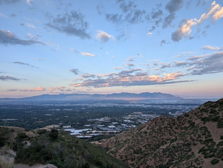


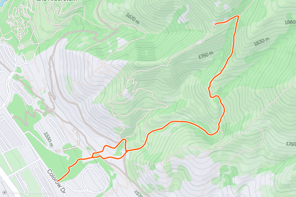
Living Room Trail
The Living Room Trail is a fun hike to a couch-like rock formation with views of Salt Lake City. From the top you’ll take in views of the city and the surrounding Wasatch Valley. The trail follows an out and back route with one split section where the ascending and descending routes are slightly different. Because of the elevation gain, most hikers consider this a hard hike. This is one of the most popular trails in the area with Strava members.
2


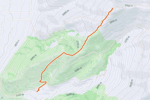
Jack’s Mountain via Jacks' Peak Trail
Jacks Mountain and Jacks Peak Trail were named in honor of a young Salt Lake City resident who lost his battle with cancer in the 1990s. At the summit, you’ll find a mailbox that serves as a memorial where hikers leave notes. The trail follows an out and back route. Because of the steep grades, most consider this a hard hike. This is one of the most popular hikes in the area with Strava members and the views from the top are spectacular.
3


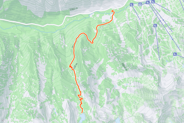
Red Pines Lake Trail
The Red Pines Lake Trail is a beautiful hike that ascends to an alpine lake. Hikers can also continue to the summit of Pfeifferhorn peak, which adds several miles to the round trip. The Red Pines Lake trail follows an out and back route. Because of the length and several steep sections, most hikers consider this a harder trail. This is one of the most popular hikes near Salt Lake City among Strava members.
4


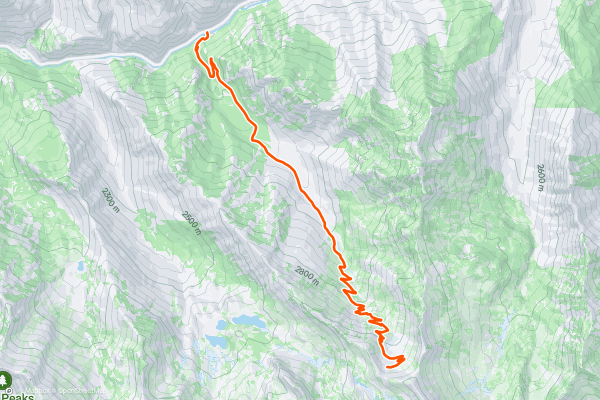
Mineral Fork
The Mineral Fork trail is a moderate hike along an old mining road with over 3,000 feet of elevation gain in 9 miles round trip. It starts with some switchbacks through the woods and opens up into a very rocky and rugged canyon with a rich mining history....
5


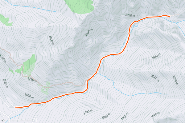
Heughs Canyon
The Heughs Canyon trail starts from the upscale subdivision off of Wasatch Boulevard. This is a roughly 3.7-mile round trip hike that only gains 1,000 feet in elevation.
Getting onto the trail from the neighborhood can be a little tricky....
6


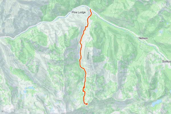
Cardiff Fork
Cardiff Fork is a very scenic and moderate hike up one of the most popular canyons in the Wasatch. The climb is a bit over 2,500 feet in 3.5 miles (one-way) passing by some old mining relics and entering the upper alpine ridges....
7


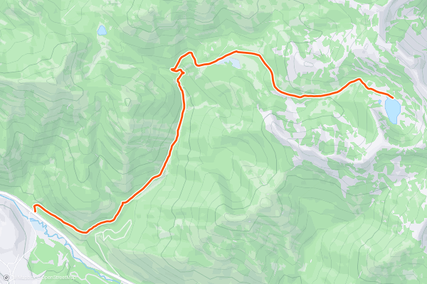
Desolation Lake
The Desolation Lake trail is almost 8 miles roundtrip with 2,000 feet of elevation gain. Its a moderate/easy trail through some shady aspen and pine forests leading to a small and quiet lake tucked at the base of the Wasatch Crest....
8


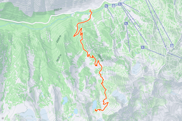
White Pine
The trail starts out moderate and continues as such for almost 5 miles until it reaches a lovely little alpine lake beneath some rugged granite peaks. The trail is well marked and heavily trafficked, but the scenery and surroundings will make it apparent why that is....
9


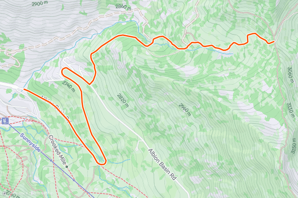
Twin Lakes Pass
The Twin Lakes Pass trail is a short hike up a road grade that ends with enjoyable views back down Little Cottonwood Canyon to the west and out over the Twin Lakes to the east....
10


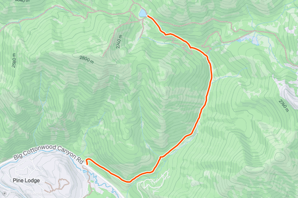
Dog Lake
This hike to Dog Lake is a short and wooded trail of mostly easy angle except for one steep final climb to the lake. It climbs a little over 1000 feet in the 2 1/2 miles it takes to gain the lake....
11


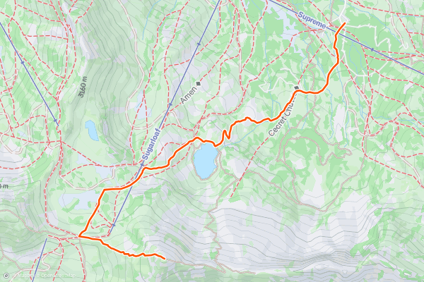
Sugarloaf
The Sugarloaf trail takes a nice path past the lovely Cecret Lake and up onto Sugarloaf peak. It covers four miles round trip as it climbs 1,600 feet. The trail is mostly moderate until the steep and loose rubble that leads to the summit....
12


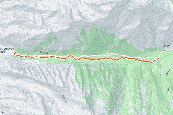
Little Cottonwood Canyon Trail
The Little Cottonwood trail is a moderate 7 miles of rocky road that runs along the creek through some nice, shady woods. From the parking lot, it follows some open doubletrack that then turns into a rocky old jeep road....
13


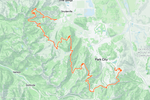
Mid Mountain Trail
The Mid Mountain Trail is a traverse of more than 20 miles, but it's easily broken into sections for shorter day hikes. The trail links multiple mountains in Park City and Deer Valley Resorts, connecting with many other trails along the way....
14


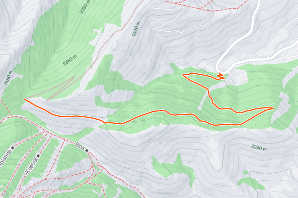
Rob's Trail
Rob’s Trail begins from a small roadside parking area on Bear Hollow Drive, near the Utah Olympic Park. It enters the forest and heads uphill immediately, climbing through a few sunny patches, but mostly staying in the shady forest on its way to the ridge crest....
15


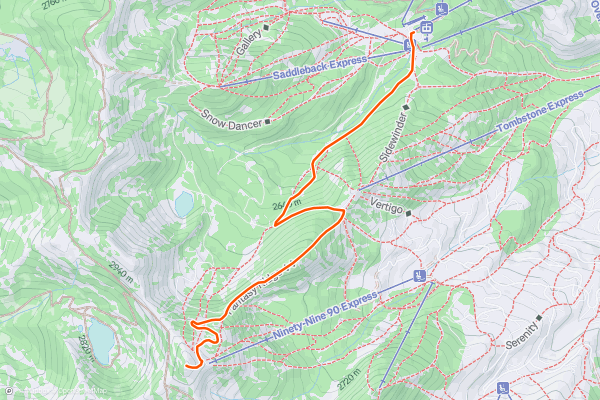
Fantasy Ridge
Fantasy Ridge is a truly unique hike in Park City. It begins much like other trails, crossing ski runs and service roads, but it culminates in an exposed, steep-sided ridge in a wild place where no other trails go, and no mountain bikers can ride....
16


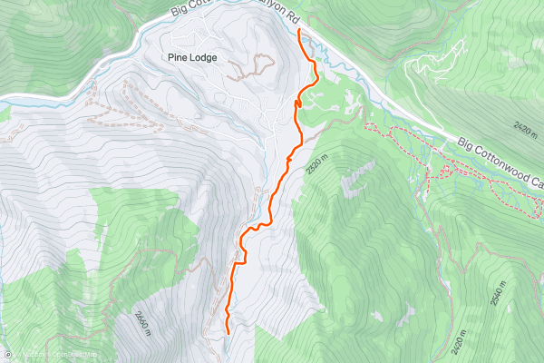
Donut Falls
Thanks to its easy access right off the pavement and the unique waterfall feature, Donut Falls is one of the most popular hikes in Big Cottonwood Canyon.
While there is a small trailhead closer to the waterfalls, due to the popularity of this hike, it's difficult to get a parking spot there, so the route mapped here begins from a larger trailhead located on the shoulder of the highway....
17


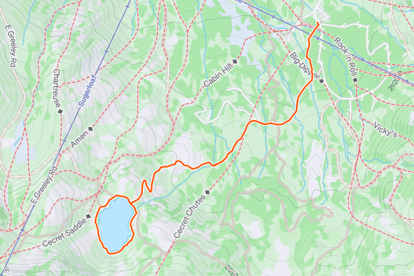
Cecret Lake Trail
Easily accessed from Albion Basin Campground (which - due its high altitude location and the famously deep Utah snowpack - is only open from mid-June to mid-September), this is a fantastic hike into a wild-feeling lake in amongst stunning alpine peaks....
18


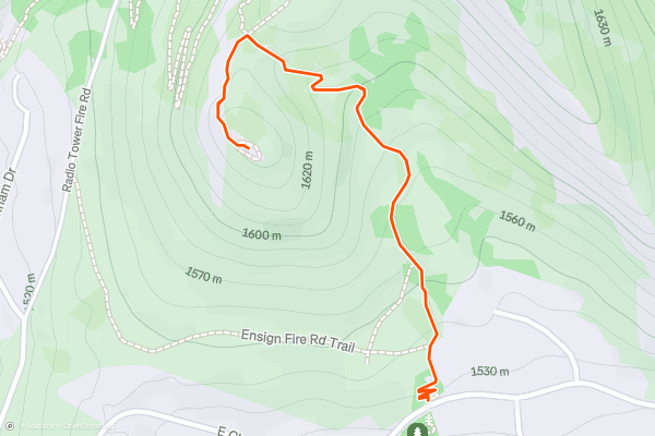
Ensign Peak
If you're looking for a short and steep hike with amazing views of Salt Lake City and the surrounding mountains, you might want to check out the Ensign Peak Trail and Overlook....
19


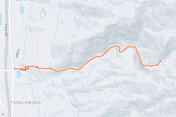
Adams Canyon Trail
The objective of this hike is obvious: the thundering waterfall hidden in the depths of Adams Canyon. The falls itself is about 40 feet tall, crashing into a shallow pond at its base....
20


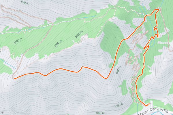
Rattlesnake Gulch Trail
The Rattlesnake Gulch Trail is a fun, winding hike that delivers hikers to great views of Salt Lake City. On this route, you’ll first climb the Rattlesnake Gulch Trail then connect with the Pipeline Trail which takes you along a ridge to the viewpoint. There are options to make the first part of this trail a loop, but most hikers follow the out-and-back route. Because of the steep grades in the first mile, most hikers consider this a hard trail. This is a popular hike with Strava members in Salt Lake City. Take a look at the pictures from the community to get a sense of what you’ll see at the top.
Page 1 of 3
Top regions for hiking trails on Strava
- Acadia National Park
- Alabama
- Alaska
- Albuquerque
- Alyeska
- Angeles National Forest
- Arizona
- Arkansas
- Austin, TX
- Bay Area
- Bend
- Big Sky
- Blue Mountain Ski Area
- Boston
- Boulder, CO
- Brevard
- Bridger Bowl
- Buena Vista
- California
- Cape Cod
- Colorado
- Connecticut
- Dahlonega
- Downieville
- Ellijay
- Flagstaff
- Florida
- Georgia
- Glacier National Park (USA)
- Grand Teton National Park
- Great Smoky Mountains National Park, TN
- Hawaii
- Hurricane
- Hyalite
- Idaho
- Illinois
- Indiana
- Kansas
- Kentucky
- Lake Tahoe
- Las Vegas, NV
- Los Angeles, CA
- Maine
- Mammoth Mountain
- Marin County
- Maryland
- Massachusetts
- Maui, HI
- Michigan
- Minnesota
- Missouri
- Moab
- Montana
- Mount Rainier National Park
- Mt. Rainier National Park, WA
- Nederland
- Nevada
- New Hampshire
- New Jersey
- New Mexico
- New York
- New York, NY
- North Bridgers
- North Carolina
- North Dakota
- Oakridge
- Ohio
- Oklahoma
- Oregon
- Park City and Deer Valley
- Pennsylvania
- Phoenix, AZ
- Placitas
- Portland, OR
- Roanoke
- Salida
- Salt Lake City, UT
- San Diego, CA
- San Francisco, CA
- Santa Fe, NM
- Santa Monica Mountains
- Seattle, WA
- Sedona, AZ
- Sisters
- South Carolina
- South Dakota
- South Lake Tahoe, CA
- Stowe
- Sugarbush
- Sun Valley
- Taos
- Telluride
- Tennessee
- Texas
- Timberline Lodge Summer
- Utah
- Vermont
- Virginia
- Washington
- West Virginia
- Wind River Range
- Winter Park
- Wisconsin
- Wyoming
- Yellowstone National Park
- Yosemite National Park, CA
- Zion National Park, UT