

+ 98
Montara Mountain from Gray Whale Cove
Hiking Trail
Hard
5.9 mi
1,822 ft
A sea-to-summit hike with panoramic views the entire way.
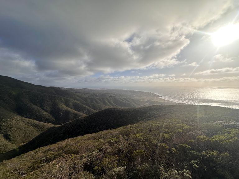
Gray Whale Cove State Beach is a popular hiking destination of its own, but the journey up Montara Mountain quickly leaves the sea-level trails for panoramic slopes above. This hike follows trails and a fire road to reach North Peak of Montara Mountain. The road is fairly mellow gradient, but some of the trail sections are very steep and loose. Most of the trails are just shortcuts from the fire road, however, so it’s possible to avoid the steepest parts by detouring on the road.
The actual summit of Montara is occupied by signal towers, but the real highlights are the views along the way to reach it. You’ll enjoy ever-expanding vantage over craggy coast and sandy coves below, as well as the beach towns of Linda Mar and Montara—if the air is clear, that is. Foggy days bring a different and often more dramatic aura to the mountain, and can still be great for hiking. Often the fog will burn off in the afternoon, or you’ll rise above it as you hike, and end up looking down on a shrouded coast from above.
The entire hike is on open slopes with low vegetation, making for great views but no shade or shelter from the elements. Sea breezes usually keep the lower elevations cool, but the higher elevations heat up quickly in the sun. Expect rising temperatures as you ascend, and bring more water than you think you’ll need.
Sources:
Written by Jesse Weber
Route and Elevation
Segments
| Name | Distance | Elev. Diff. | Avg. Grade |
|---|---|---|---|
| Cabrillo Highway Climb | 0.35 mi | 407 ft | 21.6% |
| Montara Hill | 0.19 mi | 335 ft | 33.4% |
| Parking lot to North Peak's summit | 2.88 mi | 1,690 ft | 11.1% |
| Old San Pedro Mtn rd - Nick's Revenge climb | 0.19 mi | 75 ft | 7.3% |
| North Peak Rd Steep Climb | 0.72 mi | 597 ft | 15.5% |
| San Pedro Mountain Rd Climb | 0.80 mi | 417 ft | 9.7% |
| N Peak rd climb from Montara mtn trail junction | 1.00 mi | 410 ft | 7.6% |
| N Peak rd - Montara mtn tr to Alta Vista | 0.77 mi | 351 ft | 8.6% |
| San Pedro Mountain Rd Climb | 0.37 mi | 151 ft | 7.4% |
