

+ 79
Mission Peak via the Hidden Valley Trail
Hiking Trail
Hard
6.14 mi
2,123 ft
The most direct route to a panoramic summit over Silicon Valley.
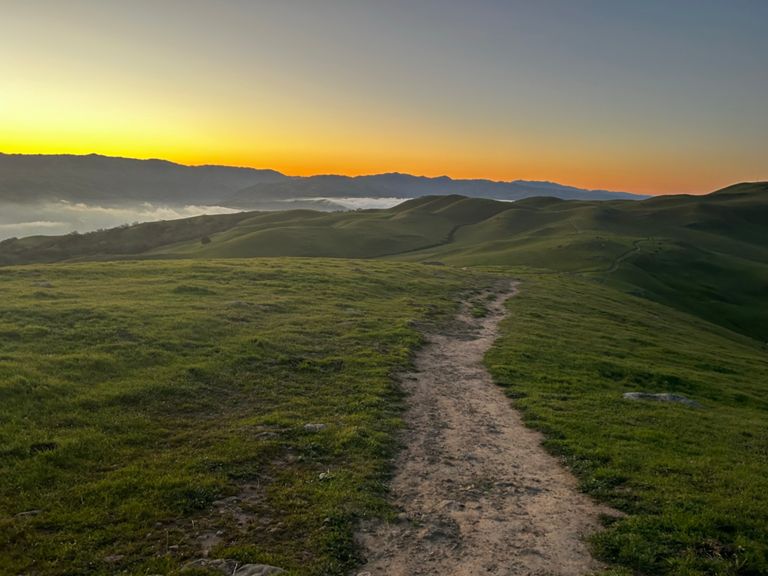
Mission Peak is one of the more prominent mountains of the Bay Area, defining the horizon east of South Bay. At just over 2,500 feet elevation, it sets the stage for hikes with pretty serious elevation gain. There are several trails, but Hidden Valley is the most direct and most popular route to the summit. It’s a wide gravel path and very easy to follow, but sustains a demanding grade for most of its 3 miles.
The work to reach the top is well worth it, because Mission Peak is an exceptionally beautiful mountain. Its grassy, sinuous slopes are adorned in green and dotted with light-colored rocks, while leafy foliage fills in the many shallow canyons. Colors are bold green with the accent of wildflowers in spring, and pale gold with amber hues in the dry season. It can even get a dusting of snow in winter. Sparse trees allow great distant views, as well. On a clear day you can easily see across the Bay to Mount Tamalpais, and to the east you might even see the outline of Sierra Nevada peaks. Wildlife you might spot are deer, rabbits, turkeys, hawks, and a free-roaming herd of goats.
The trail is not overly difficult, but is completely exposed to sun and wind. Come prepared with good shoes, sun protection, and layers of clothing. Parking is limited at the Stanford Avenue Trailhead where this hike begins. Do your best to get there early or come on a weekday. You can alternatively get there by rideshare services or public transport.
Sources:
Written by Jesse Weber
Route and Elevation
Segments
| Name | Distance | Elev. Diff. | Avg. Grade |
|---|---|---|---|
| Mission Peak - Stanford gate to 1st bench | 0.75 mi | 417 ft | 10.5% |
| Mission Peak - Ankush | 2.84 mi | 1,926 ft | 12.8% |
| Stanford Trail (from gate to Grove trail intersection) | 2.15 mi | 1,388 ft | 12.2% |
| Sanford Rd Gate to Y | 2.28 mi | 1,542 ft | 12.8% |
| The real mission peak hike | 3.04 mi | 2,070 ft | 12.9% |
| Mission Peak - Parking Lot to Pole (No Shortcuts) | 3.00 mi | 2,110 ft | 13.3% |
| Mission Peak - 1st bench to 2nd bench | 0.34 mi | 256 ft | 13.7% |
| Mission Peak - 2nd Bench to 3rd Bench | 0.27 mi | 210 ft | 14.7% |
| Mission Peak - 3rd Bench to 4th Bench | 0.51 mi | 377 ft | 13.9% |
| Horse Heaven Trail Climb | 0.34 mi | 302 ft | 16.4% |
| Mission Peak - 4th Bench to Y | 0.51 mi | 305 ft | 11.1% |
| Peak Trail Climb | 0.49 mi | 341 ft | 13.2% |
| New Push to Peak | 0.59 mi | 505 ft | 16.1% |
